Hey there,
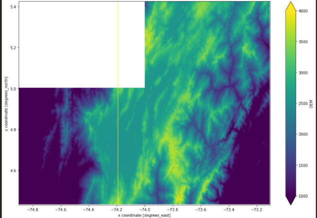
There are missing data in the DEM data gained from the COPERNICUS_30 collection. Additionally, a vertical line (yellow) is occurred in the output raster. Please can you advice why the output raster looks like this.
dem_cube = connection.load_collection(
    "COPERNICUS_30",
    spatial_extent = {'west': -74.9  , 'east': -73.106493944999954, 'south': 4.432483427000022, 'north': 5.425259437000022},
    temporal_extent=["2010-01-01", "2030-12-31"])

dem_cube = dem_cube.max_time()
dem_cube.download("poc-copernicus30-raw.nc")
Output raster:
Thank you
Hi Andrea,
we already noticed ourselves while working on this case, and will be looking into it.
We’ll let you know when it’s solved, do let us know if there’s any specific priority.
best regards,
Jeroen
Hi Andrea,
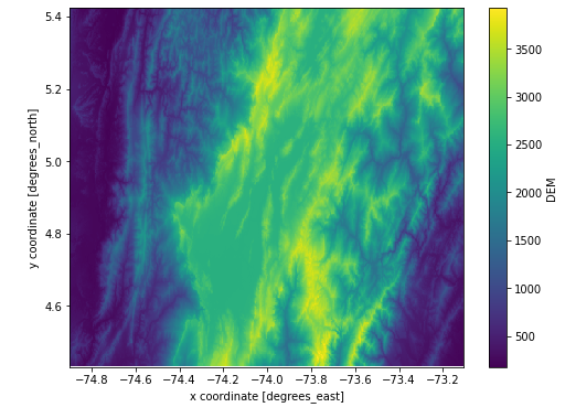
it’s partially solved on openeo-dev.vito.be, the big missing chunk is gone now. The single line of missing pixels is still there. (We’ll look into that as well, but I’m hoping that this already solves the main issue.)
best regards,
Jeroen
As mentioned in broken `COPERNICUS_30` collection · Issue #180 · Open-EO/openeo-geopyspark-driver · GitHub the problem is fixed on openeo-dev.vito.be back-end
For example, using the original snippet of this thread:
2 Likes
Thank you Stefaan. That was quick!