Hi all,
In my current use case I’m debugging this simple workflow (notebook using CDSE):
https://github.com/EO-College/cubes-and-clouds/blob/main/lectures/3.1_data_processing/exercises/31_data_processing_cdse.ipynb
I also tried to run the same using openEO Platform and the SENTINEL2_L2A_SENTINELHUB collection but it resulted in an excessive amount of credits used, which is going to be checked by SentinelHub (cc @daniel.thiex).
I finally created the (almost) same workflow using load_stac and client side processing. I’m just missing the filter_spatial/mask_polygon which are not yet available in openeo-processes-dask. Notebook available here:
https://github.com/EO-College/cubes-and-clouds/blob/main/lectures/3.1_data_processing/exercises/31_data_processing_stac.ipynb
The final plot in the CDSE linked notebook seems wrong to us. This might be due to what kind of data is returned when requesting our bbox.
Our AOI lay between two S2 tiles:
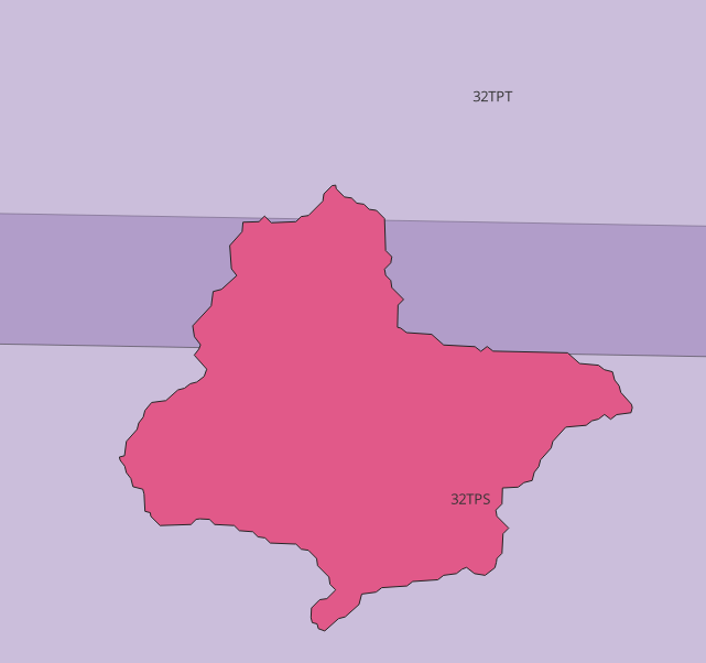
I guess that, when setting the spatial extent in load_collection to the bounds of this polygon, the back-end returns data of both tiles. Without knowing from which tile each time step comes from, it’s difficult for us to evaluate the data.
After this introduction, the questions:
- Is it possible to filter the data using the tile id? Similarly as we do with the Sentinel-1 orbit or Sentinel-2 could cover?
I guess it’s not, since I tried and I got this error:
OpenEoApiError: [500] Internal: Failed to process synchronously on backend vito: OpenEoApiError(‘[500] Internal: Server error: org.openeo.geotrellissentinelhub.SentinelHubException: Sentinel Hub returned an error\nresponse: HTTP/1.1 400 Bad Request with body: {“code”:400,“description”:"Querying is not supported on property 'tileId'. Possible properties are 'eo:cloud_cover'."}\nrequest: POST https://services.sentinel-hub.com/api/v1/catalog/1.0.0/search with (possibly abbreviated) body: \n{\n “datetime”: “2018-02-10T00:00:00Z/2018-02-12T23:59:59.999999999Z”,\n “collections”: [“sentinel-2-l2a”],\n “filter”: “tileId = '32TPS'”,\n “intersects”: {“type”:“Polygon”,“coordinates”:[[[11.020833333333357,46.65359937879776],[11.020833333333357,46.954166666666694],[11.366666666666694,46.95416666666669],[11.366666666666694,46.653599378797765],[11.020833333333357,46.65359937879776]]]},\n “limit”: 100,\n “next”: null\n} (ref: r-2129874c3a5c41d08cde14cd734b98ee)’) (ref: r-4ec0c9702e844e3a906f7fcedd9a4381)
- Is it possible to distinguish from which tile the data comes from to filter it later on?
- If
load_stacwould properly work, I would like to try using the same data as the one used locally, but currently it doesn’t seem to be possible: https://helpcenter.dataspace.copernicus.eu/hc/en-gb/community/posts/13919325025181--openEO-load-stac-process-not-working-with-public-catalogs?page=1#community_comment_13930291736349
Thanks in advance for the help!
Michele