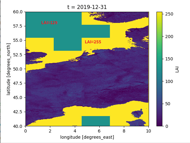
I downloaded the CGLS_LAI_V2_GLOBAL dataset, with the extent W=0, E=10, S=40, N=60.
Parts of the sea (near the coast) are filled in with the correct fill value of 255. However, further out at sea the fill value is 129, which is a value for correct data as well.
See the following plot:
Note that the only band available for this collection is “LAI”. While the Copernicus GLS page states that there is also a QFLAG layer which includes the land/sea mask.